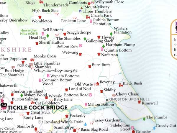
Some of those I know (Wetwang is famous throughout the English-speaking world) and some of them I don't (Tickle Cock Bridge, which is in the map's top 50, is a new one on me). Some of them aren't really all that amusing (is Beverley there because it can be misread as "Beaverley" or something?). Others are amusing as written (Skidby looks like "skid by") but aren't pronounced that way (the "y" in Skidby is pronounced the same way as the "i"); this is why towns elsewhere on the map such as Penistone feature in the map's top 50.
There are so many places in England with "Bottom" as part of their name, and so many in Wales with "Pant" as part of theirs that they have their own map symbols. It turns out that they both mean the same thing: a valley.
The map doesn't just include towns and villages: it has farms, buildings, streets, geographical features and pieces of history. I'm therefore confused as to why Sherburn in Elmet gets a mention but Swine and the Land of Green Ginger don't. The compilers must not have asked locals for ideas.